Learn here about the technologies that are being used in the Americas for the integrated management of water resources and good agricultural practices.
Technology Atlas
3D printing


3D printing uses computer-aided design (CAD) to create three-dimensional objects through a layering process. This technology is applied in agriculture to manufacture a wide range of objects needed in agricultural processes.
AFINS_2.0


AFINS 2.0 is software developed by IIAMA-UPV for the statistical analysis of extreme hydrological events. It allows users to work with observed, historical, or paleohydrological data, even if incomplete, using advanced estimation methods and various statistical distributions. It facilitates the calculation of return periods and quantiles of flows or rainfall, supporting the assessment of hydrological risk in water management and safety studies.
AQUACROP


AquaCrop is a FAO simulation model that estimates crop growth and yield based on the interaction between climate, soil, water, and agricultural management. It focuses on water productivity, making it especially useful in water-scarce conditions. It uses data such as temperature, precipitation, and soil characteristics to simulate key processes and support irrigation planning and agricultural decision-making in an efficient and sustainable way.
AQUAMAPS


AQUAMAPS, developed by FAO as a complement to AQUASTAT, is an online geospatial database on global water and agriculture. It allows users to download GIS layers (watersheds, rivers, water bodies, irrigation, dams, and climate) and derived products based on AQUASTAT models.
AQUATOOL

AQUATOOL is a decision support system for modeling and managing river basins. Using different modules, it allows users to simulate water distribution, quality, risks, and infrastructure operation. It is a flexible tool that is widely used in basin plans in Spain and various other countries.
Acoustic nanotubes

Carbon nanotubes, composed of cylindrical carbon molecules with a diameter of a few nanometers (one millionth of a millimeter), possess electronic, mechanical and chemical properties that are highly applicable to new technologies for the treatment of contaminated water.
Aerial and aquatic drones

_svg.png)
Drones offer an alternative to satellite-based global positioning systems, being less affected by adverse weather conditions and more flexible for collecting data on land and crops.
Aeroponics


In aeroponics, the plants are placed on a structure that holds them, leaving the aerial part visible, so that it receives light, and on the other side are the roots, which remain hanging in a closed environment, leaving them free of soil, substrates or aqueous solutions.
AgSense

_svg.png)
AgSense is an irrigation management platform that allows users to monitor and control irrigation systems remotely from a PC, smartphone, or tablet. It offers equipment control (such as center pivots), real-time monitoring of weather and soil moisture with alerts, and customizable reports to support decision-making.
AgTech: FONTAGRO sensor

Digital technologies can be part of the solution, as they enable more efficient, productive and sustainable agriculture by optimising its processes to produce more quality food in a more sustainable way.
AgriMet

AgriMet is a network of weather stations that collects real-time climate data (temperature, humidity, rainfall, wind, and solar radiation). This information is used to generate daily statistics and key estimates for agriculture, such as growing days and evapotranspiration.
Agricultural cloud systems


Cloud systems are essential for agricultural information management, as they allow for remote storage and control of data, replacing the need for hardware and software. This saves resources and facilitates decision-making by analysing elements such as soil, plants and water in real time.
AirDrop

_svg.png)
The AirDrop irrigation system is a revolutionary innovation in gardening and agriculture, specially designed for dry climates. Using a turbine powered by a small solar panel, it captures moisture from the air and condenses it in an underground reservoir to irrigate gardens and orchards.
Anomaly detection

_svg.png)
It is a crop monitoring tool that enables early detection of field anomalies. Users define an area and a date, and the system analyzes the data to identify zones with abnormal growth or crop health, highlighting potential issues such as water stress, nutrient deficiencies, or pests, enabling fast and precise intervention.
AquaSpy

The AquaSpy platform is an advanced agricultural technology solution designed to optimize irrigation and improve crop management. AquaSpy helps farmers improve irrigation efficiency, reduce water waste and increase crop productivity, thus contributing to more sustainable agriculture, showcasing solutions for soil moisture monitoring, data analysis and nutrient management.
Aquadetect

Aquadetect is a Chilean company whose objective is to develop technological solutions for water management, mostly focused on agricultural lands. They are specialists in the exploration and use of underground water resources for crops.
Aquaponics


Aquaponics is a food production system that combines the raising of aquatic animals (aquaculture) with the cultivation of plants in water (hydroponics), by continuously recirculating water through the two subsystems.
Arable

Arable is a crop intelligence platform that combines advanced sensors and agronomic models to provide real-time weather, plant, soil and irrigation data. Its goal is to help farmers make informed decisions that improve the productivity and sustainability of their crops. In addition, it is easy to set up and use, enabling quick benefits.
ArcGis for georeferenced water modeling

ArcGIS is a complete system for collecting, organizing, managing, analyzing, sharing, and distributing geographic information. In agriculture, ArcGIS can capture the Normalized Difference Vegetation Index (NDVI), which is crucial for estimating crop quantity, quality, and development.
Artificial intelligence

Data-driven agriculture benefits from technologies such as artificial intelligence (AI), which enables prediction and agile response to unforeseen events. AI analyzes data from various sources, such as satellite images, to provide farmers with accurate, real-time information.
Artificial wetlands

Constructed wetlands are water treatment systems that mimic the purification processes present in natural wetlands. These systems are part of the non-conventional, low-consumption wastewater treatment technologies. They are based on the interaction between phytoremediation (plant action) and microbiological processes.
Ashkelon desalinization plant

The Ashkelon desalination plant, one of the largest and most advanced in the world, uses membrane technology with an innovative design that optimizes reverse osmosis, reducing costs and increasing efficiency. It provides around 15% of Israel’s daily drinking water and features advanced boron removal and energy recovery systems, positioning IDE as a leader in large-scale desalination megaprojects.
Assistant: Questions and answers about agriculture

AI assistant that provides immediate, expert answers to agricultural questions, supporting decisions on crops, soil, and pests.
Auravant


Auravant is a precision agriculture application designed to help farmers manage their fields more efficiently and sustainably. The platform unifies data and transforms it into useful information for decision-making, optimizing the use of inputs such as water, fertilizers, and seeds. Users can access satellite images, yield maps, weather forecasts, and much more. It features GNDVI, which helps determine the amount of water and nitrogen plants are absorbing. This is crucial for optimizing irrigation and ensuring crops receive the right amount of water, avoiding both excess and shortages.
Biobeds


Biobeds are systems designed to degrade pesticides and other phytosanitary products that remain as residues after cleaning agricultural application equipment. These beds are composed of a mixture of straw, soil and compost, which encourages the growth of microorganisms capable of decomposing contaminants before they reach the soil or water. Pollution prevention: By degrading pesticides, biobeds prevent these chemicals from reaching surface and groundwater sources.
Biochar
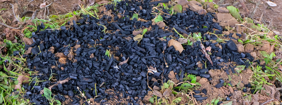
Biochar is a carbonaceous material obtained by pyrolysis of biomass (agricultural residues, forest residues, manure) in the absence or with little oxygen. It has a porous structure, rich in carbon and very stable, which gives it benefits for improving soil, retaining water, and contributing to carbon sequestration.
Biopesticides

Biopesticides are developed from substances of botanical and microbiological origin. They provide natural protection for crops in the fight against pests and diseases, and allow food to be obtained without chemical residues.
Biotechnology: transgenic seeds

Agricultural biotechnology contributes to the sustainable use of this resource through the development of drought-resistant transgenic crop varieties or with current crops whose characteristics – such as insect resistance and herbicide tolerance – preserve resources such as water and soil.
Bluleaf


Bluleaf is a digital platform designed to optimize agri-food processes through digitization. It offers tools to improve operational efficiency, facilitate decision-making, and promote professional collaboration. It focuses on environmental sustainability and food security, with support for irrigation, nutrition, plant protection, and advanced data management and geospatial services.
BoosterAgro

BoosterAGRO is an application designed for farmers that centralizes all the climatic, agronomic and productive information of their fields. Its main components include weather forecasts, crop monitoring, rainfall maps and climate reports essential for the optimization of crops, water and soil.
Brazil Drought Monitor

The Brazil Drought Monitor is a tool that continuously monitors the severity of droughts in the country. This monitoring is based on climate indicators and the impacts caused by the phenomenon in both the short and long term. The program publishes a monthly map showing the drought situation in the different federal units of the previous month. This map uses a color scale to indicate the degree of severity of the drought, which can be: severe, moderate, severe, extreme or exceptional.
Breakwaters

Groynes, also called breakwaters or jetties, are transversal works that advance from the existing shore to the new shore line, to reduce the excessive width of the riverbed, causing sedimentation in the area limited by them and generating a displacement in the axis of the riverbed; they channel, correct or control the natural course of the water. These works have the purpose of directing the flow of the current, preventing the forces of the water from impacting on the margins.
Caburé

The Caburé platform is an innovative tool used to integrate weather and field data. This platform provides detailed information on weather events and field conditions through a web and mobile application.
Carbon stock

It is a forest analysis tool designed to calculate and project carbon reserves and CO2 sequestration. It allows users to upload tree sampling data to estimate biomass, establish a carbon baseline, and forecast future growth, supporting the quantification of carbon assets for credits and sustainable management.
Cardboard donuts

The tree planting project in the Atacama Desert has found a way to reclaim these lands, by planting trees in a clever ‘Cocoon’. The circular biodegradable cardboard structure can hold up to 25 litres of water, which the young tree can live off of as its roots grow. Up to 90% of trees planted in one of these cardboard ‘donuts’ survive, even during droughts. Overall, the Cocoon method uses five times less water than irrigation.
Celery

The Apio app is a farm management platform that centralizes climate, agronomic and production information to help farmers make informed decisions and improve the efficiency of their operations. The app provides weather forecasts, monitors crops, manages resources used, including water, and provides alerts and notifications.
Center pivot irrigation

Center pivot irrigation, an automated sprinkling method in a circular pattern, not only irrigates but also applies fertilizers and chemicals.
Cesens®

It is an Agroclimatic Information System for decision-making in agriculture. It is based on stations that collect data from crops to obtain value-added information, such as the risk of infection or the need for irrigation. Cesens® agroclimatic stations are installed in the crop plots and send the data they collect to the cloud platform in real time.
Chaac Ha

This is a water harvesting concept that can collect water from both dew and rain. It is designed to be portable and affordable. It is inspired by nature in two of its key features. First, the shape and material of the rainwater-collecting membrane are inspired by the way bromeliads channel water into a central pond. Second, the structure supporting the membrane is inspired by a spider web, with its radial bamboo struts held in place by the tension of the membrane and by concentric radial cords, just as the radial cords of a spider web are separated by concentric radial threads.
Channels guard

Guard channels are ditches built near crops to efficiently direct water and prevent soil erosion, as well as avoiding the washing away of the fertile soil layer. These structures allow for better water management by directing it to specific areas of the farm, contributing to irrigation efficiency and preventing flooding.
Chinampas

Chinampas are plots of land that float on shallow water. They were constructed artificially and are intended to provide the vegetables needed for local consumption. They are built by piling up earth and gravel on the water to create a wet surface where crops will later be planted.
Climate FieldView

Climate FieldView is a digital farming platform that helps farmers make data-driven decisions to improve the yield and profitability of their crops. In terms of water management, it enables early detection of crop water stress, optimization of water use so that plants receive the right amount at the right time, and real-time monitoring of water consumption, facilitating adjustments to irrigation practices when necessary.
Climate analysis

It is a weather analytics platform that combines historical data and advanced forecasts. Using machine learning, it generates location-based climate averages and compares them with 16-day and one-year forecasts, supporting risk assessment and strategic planning.
Cloud seeding

Cloud seeding is a weather modification technique that involves dispersing substances into clouds to stimulate precipitation. This technique is based on the idea that precipitation formation can be stimulated by altering the microphysical conditions of clouds, i.e. the amount and size of water or ice particles within the clouds.
Cocoa disease alert

It is a predictive tool that estimates the monthly risk of Black Pod Disease in cocoa-producing regions. Using a machine learning model and geolocated data, it allows users to enter their farm’s coordinates and receive an early warning about outbreak risk.
Coil irrigation

Serpentine or zigzag irrigation are grooves made in the ground to provide controlled (directed) flow of water below the surface of the crop. The type of furrow will depend on the slope of the land: if it is low in slope, linear furrows are used, but if there are relatively steep slopes, an option to use are “S” shaped furrows or ditches, which are also used on low slopes, in order to have greater control over the conduction of irrigation water.
Communal reservoirs

The technology consists of the installation of multi-family micro-reservoirs connected to collective parcel irrigation systems, which are managed by irrigation committees.
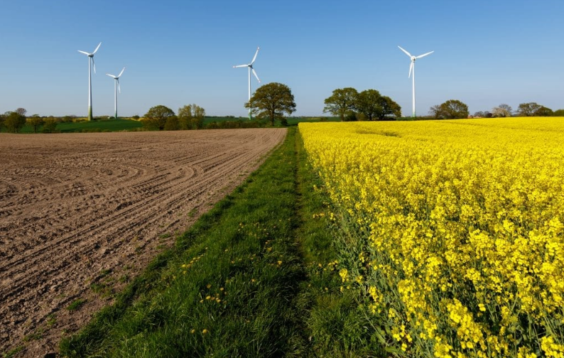
Conservation agriculture
Conservation agriculture is a sustainable system that improves soil health and water use, based on keeping the soil covered, reducing tillage, and diversifying crops. These principles strengthen biodiversity, prevent soil degradation, and promote more efficient water management, which increases resilience to climate change.
Crop progression

It is a crop monitoring tool that uses satellite imagery to assess agricultural health and development over time. Users define their field, select a date and a vegetation index, and the system generates color-coded maps that help identify stress and support data-driven management decisions throughout the season.
Crop rotation
Crop rotation is an agricultural technique that involves alternating different crops on the same land to improve soil health, reduce pests, and preserve fertility. This practice also optimizes water use, improves soil structure, and contributes to more sustainable agriculture that is resilient to climate change.
Crop strip

This practice consists of sowing grass species on the perimeter of the crop, or even other types of crops in a strip that is 3 to 5 m wide. Its use can also be complemented with other buffer practices within and between fields. Shrub, grass and grass species adapted to the area are established on the edges of the field. To do this, a good sowing or planting process must be carried out, which implies paying attention to the preparation of the land, the density of sowing, the depth, the management of dates, etc.
CropX

CropX is an advanced farm management platform that combines soil sensor technology with a comprehensive digital platform to optimize farming operations. This platform is designed to facilitate accurate decision making and improve agricultural productivity in a sustainable manner.
Curves with vetiver

Vetiver is a dense root system used in crops with steep slopes or hillsides, it helps prevent soil erosion, ensuring stability over time, acts as a natural barrier to retain sediments, protecting nearby bodies of water and improving water quality.
Dams to store rainwater

Albarradas are artificial wetlands with slow-moving waters, which have long been known in South America under various names such as jagüeyes, ciénagas, represas or lagunas.
Decagon Devices

Decagon Devices is an American company that designs and markets scientific instruments, sensors, and data loggers for applications in environmental and food sciences, including sensors for measuring soil water activity.
Deforestation SAR

It is an advanced change detection tool for forest monitoring in any climate using SAR radar and machine learning. It processes multi-year satellite data into an RGB image that enables rapid identification of deforestation, regeneration, and land disturbances, even under cloud cover.
Deforestation detection


It is a machine learning–based monitoring tool that detects and quantifies historical forest loss using satellite imagery within a user-defined area, generating multi-year reports to support environmental monitoring and regulatory compliance.
Deforestation reports

It is a centralized management dashboard that securely stores and organizes deforestation detection reports. It allows users to track analysis history, check the status of each report, and download results for compliance records and historical data.
Digital Green

This is a video platform aimed at the agricultural community and disseminated through local social networks to encourage farmers to adopt new practices to improve their livelihoods and share knowledge with other stakeholders in the sector.
Ditch careo

Careo is a system of Muslim origin by which farmers guide water from snow-capped mountains to aquifer recharge zones. When the heat begins, they use a system of irrigation ditches to transport the water from the thaw so that it infiltrates the aquifers and appears in the rivers and springs after two or three months, in the middle of summer when it is most needed for irrigation.
Drip irrigation

Water and nutrients are delivered to the field through a system of pipes called “drip lines,” which contain small devices called “drippers.” Each dripper emits a controlled stream of droplets containing water and fertilizer, resulting in an even application of water and nutrients directly to the root zone of each plant throughout the entire field.
EDANA

The EDANA platform is a soil moisture sensor system designed to optimize irrigation in agriculture. It uses Internet of Things (IoT) technology to transmit real-time data on soil moisture, allowing farmers to receive accurate alerts on when to turn irrigation on or off. In short, EDANA helps manage water more sustainably and efficiently, which is crucial in a context of increasing water resource scarcity.
ESG compliance analyzer

It is an AI-based tool that automates the analysis and verification of ESG reporting compliance in line with the European Sustainability Reporting Standards (ESRS). It processes sustainability documents to generate summaries, identify relevant ESRS topics, and assess compliance levels, streamlining the audit process.
ESRS Objectives and Targets Analyzer

It is an AI-powered analysis tool that automatically reviews ESG reports in line with ESRS topics. By analyzing an uploaded document, it verifies whether objectives, targets, metrics, and monitoring methods are clearly stated and generates a rapid gap assessment to ensure strategic clarity and compliance.
EUDR Intelligent Assistant

It is an intelligent question-and-answer assistant that provides fast and clear guidance on the EU Deforestation Regulation (EUDR), helping users understand and meet their regulatory obligations through natural language queries.
Economic incentives in Jamaica for watershed management


CATIE (Tropical Agricultural Research and Higher Education Center), in collaboration with government agencies in Jamaica, is implementing an incentive program for small farmers. The goal is to promote practices that improve soil and water retention on their farms, such as natural barriers and agroforestry systems.
Estimated carbon revenues

It is a tool that estimates potential annual income from soil carbon credits by comparing user-defined farm boundaries with three soil management scenarios to quantify the financial benefits of regenerative practices.
Excavation of Vigiñas


Vigiñas are excavations in the ground with a diameter of approximately 10 to 20 meters and a depth of 1 to 2.5 meters. These technologies provide water for the dry season and help the regrowth and growth of forage species. Likewise, vigiñas or qotañas can be of different sizes and storage capacities, depending on the water requirement and availability of areas for their construction.
FarmBot

It's an open-source agricultural robot designed to automate small gardens. It uses CNC technology to sow, water, remove weeds, and scare away birds. It's controlled via a mobile app, tablet, or PC, allowing the user to design the garden and schedule the robot's tasks.
Flexi-Emas pump

These hand pumps, made of PVC or polyethylene pipe, are easy to build and adjust by cylinder diameter to control the pressure and amount of water pumped. Known as EMAS or Flexi pumps, they are adaptable and originated at the Mobile School of Water and Sanitation (EMAS) in Bolivia.
Flexible storage tank

Water storage in bag tanks is a flexible and portable solution made from a durable polyester canvas and coated with PVC for protection. Its versatility allows it to adapt to different surfaces such as cement, earth or sand.
Floating solar panels

This is a floating solar plant that uses high-density polyethylene floats instead of a standard steel structure. This installation also reduces evaporation and algae growth by decreasing exposure to the sun and limiting photosynthesis processes in the water.
Floating spheres

Floating spheres are devices used to reduce evaporation and regulate water temperature in reservoirs. Made of high-density polyethylene, they contain water inside and are placed on the surface of the water.
Floodbed irrigation

_svg.png)
Flood irrigation is applied to plots surrounded by ridges or mounds to retain water in rectangular areas with abundant water, adapting their shape to the slope of the land.
Fogcatcher

The fog catcher, also known as a fog collector, is a system used to capture the microscopic water droplets that are present in the fog and transform it into water that can be used. It is a creative way to collect water and thus avoid the droughts that plague parts of the planet where there is also fog. This system, technically, does not create water; on the contrary, the water is collected through the microdroplets that are present in the fog.
Francis turbine

The Francis turbine is a type of reaction water turbine, that is, it uses the kinetic energy of moving water as pressure energy to turn a water wheel. This turbine was developed in 1848 by the Anglo-American engineer James B. Francis and is the most widely used type of water turbine.
Fruit counting

It is a computer vision tool that performs fast and accurate fruit counts from field images. By uploading a photo of the crop, the system automatically detects and counts the visible fruit, supporting yield estimation and harvest planning.
Furrow irrigation


Furrow irrigation directs water through V-shaped furrows toward crops, allowing for uniform infiltration and preventing erosion.
Global Drought Information System (GDIS)

The Global Drought Information System (GDIS) is an international initiative that seeks to collect and compare drought information from different local and national sources. Its main objective is to provide a uniform platform for monitoring, predicting and managing droughts globally. GDIS offers tools and educational resources to help countries prepare for and respond to droughts, promoting collaboration and data sharing across different regions.
Green belts
Green belts are strips of vegetation that help manage water naturally and sustainably. They reduce runoff, filter pollutants, prevent erosion, and mitigate flooding. In addition, they improve biodiversity and the landscape and provide green spaces for the community, making them an effective solution to climate change.
GroGuru

GroGuru is an agricultural technology that improves irrigation efficiency through artificial intelligence and continuous root zone monitoring. It uses a wireless underground irrigation system (WUGS) to permanently install soil moisture sensors, providing precise recommendations on when and how much to irrigate, thereby optimizing water use and crop health.
Gully Control

Gullies are ditches caused by soil erosion, with the presence of a slope, due to the concentration of water in the ground, generally due to rain. They can be ephemeral (less than 0.5 m deep) or permanent, if they exceed that depth and cannot be covered by conventional work.
HEC-HMS hydrological simulation

The Hydrologic Modeling System (HEC-HMS) is designed to simulate the complete hydrologic processes in watershed systems. This software includes traditional hydrologic analysis procedures such as event infiltration, unit hydrographs, and hydrologic routing.
Hillside ditches
Hillside ditches are small channels built along a slope to manage rainwater and prevent soil erosion. These practices are essential for sustainable agriculture on sloping land, as they improve water management and soil conservation.
Hippo water roller


The Hippo Water Roller is a durable plastic rolling container that carries up to 90 liters of water, designed to improve water access in rural communities. Its structure reduces physical effort and improves quality of life by saving time and allowing people to focus on activities such as education and work.
Homemade solar irrigation

Homemade solar watering with bottles is a simple and inexpensive technique to keep your plants hydrated using plastic bottles and solar energy. The solar energy heats the water in the small bottle, causing it to evaporate. The vapor condenses on the walls of the large bottle and drips to the ground, watering the plants constantly. This method is ideal for small orchards and gardens, as it is easy to implement and helps reuse materials.
Hortau

It specializes in precision irrigation, providing farmers with real-time field and soil data. Its system uses soil tension probes connected to a mobile web app, allowing farmers to monitor the movement of water and fertilizers and make informed decisions about when and how much to irrigate.
HuraGis

HuraGIS is an ArcGIS extension from IIAMA-UPV that integrates climatic, cadastral, and agronomic information to calculate plot-level irrigation needs and generate optimized irrigation schedules. It helps improve the efficiency of localized irrigation, automatically updates climatic data, and allows the creation of thematic maps to assess agronomic and hydraulic management.
HydroBID Water Simulation Tool

This integrated system simulates water flow in basins using a hydrographic database for Latin America and the Caribbean.
HydroPoint

HydroPoint is a company specializing in smart water management, developing technologies to optimize irrigation, control flow, and detect leaks. Its systems combine hardware and subscription services, automatically adjusting irrigation based on the local climate. It uses IoT technology to analyze climate and soil factors in real time, improving water efficiency and sustainability.
Hydrogel

Hydrogel, also called solid water, is a potassium polyacrylate compound, which can absorb up to 268 times its weight in water through hydrogen bonding.
Hydroscrew

The hydroscrew is a turbine operated by the weight of water, acting as a gravimetric machine. The water fills the compartments of the screw, which descend due to their own weight and the helical surface of the propeller, generating the rotation of the screw and converting potential energy into mechanical energy.
IRRIGOPTIMAL®


IRRIGOPTIMAL® is an integrated agricultural management system composed of six interconnected modules. It monitors soil and climate (including GDD), optimizes irrigation using AI-based predictive plans, and manages nutrients such as NPK and pH. It also detects diseases and pests early through image analysis, providing recommendations. Finally, it automatically executes irrigation with precision according to crop needs.
Inca Moray

These are agricultural terraces or platforms built in gigantic natural depressions or holes. These terraces are superimposed concentrically, taking the form of a gigantic amphitheater. The largest hole has a depth of 150 m and the average height of the platforms is 1.80 m.
Index prediction

It is an advanced forecasting tool that uses machine learning models to predict the evolution of agricultural vegetation indices. It allows users to select a specific field and index (NDVI, MSAVI, LSWI, RECI, or NDRE) and anticipate crop health trends, supporting proactive management decision-making.
Infiltration galleries

Filter galleries, also called underground tunnels, are ancient techniques for harnessing groundwater in regions with scarce surface sources. These structures transport water over distances and have been used for agricultural irrigation over time.
Infiltration trenches

Infiltration trenches are excavations in the ground 2 to 3 meters long and 1 meter wide and deep, useful for reducing surface runoff and erosion. They are also used as part of rainwater treatment and harvesting systems, since the soil and porous materials in the trench can retain and filter pollutants from rainwater before they infiltrate into the soil.
Intermittent irrigation

The pulse irrigation system, also known as intermittent or discontinuous, consists of applying water to the furrows in short but frequent intervals during the same irrigation period.
Invigorating

Invigorating agents are compounds of natural or synthetic origin, which when applied to plants, affect plant metabolism through biochemical action mechanisms that allow for optimizing transpiration. These compounds have many advantages, since they function in part as a biostimulant and/or organic fertilizer, also providing protection against climatic stress.
Irrigation model

It consists of an irrigation model designed to simulate and optimize water distribution in agricultural systems, covering soil water balance, crop water requirements, and evapotranspiration modeling, enhanced by satellite monitoring to obtain better recommendations.
Irrigation technology

Irrigation technology is a solution to problems arising from water management and seeks to optimize agricultural yields per unit of water used. Supplying the right amount and quality of water to the crop at the right time improves production and agroecological conditions.
Irrometer

Irrometer specializes in manufacturing soil moisture measuring equipment, such as tensiometers and sensors, focused on optimizing irrigation in agriculture.
John Deere Field Connect

John Deere Field Connect is a precision farming system that allows farmers to monitor soil moisture at different depths using probes installed in the field. The information is sent to a web platform accessible from any device. In addition, it can integrate environmental sensors to measure variables such as temperature, wind, rain and solar radiation. Its main objective is to help optimize irrigation, save water and improve crop productivity and quality.
Kaplan turbine

The Kaplan turbine, invented in 1913 by Austrian professor Viktor Kaplan, is based on the principle of a ship's propeller. The Kaplan turbine is an axial type turbine in which the flow of water causes the propeller blades to rotate in and out in an axial direction relative to the propeller's axis of rotation.
Khettaras

Traditional groundwater collection and conveyance systems used in the arid and semi-arid regions of Morocco, particularly in the Atlas oases. They consist of underground galleries and vertical shafts that transport water from aquifers or recharge areas to agricultural lands by gravity. They provide irrigation, water supply, and oasis conservation, representing an ancestral technology for the sustainable management of water resources in desert environments.
La chakra andina

It is a traditional Andean agricultural system based on crop diversity, the sustainable use of natural resources, and ancestral knowledge. It incorporates efficient water management practices that support soil conservation, water regulation, and resilience to drought. In addition, the cultivation of different crops within the same plot enhances food security and biodiversity.
Land suitability model

It consists of an agricultural land-suitability model designed to assess crop viability, integrating key climate, soil, and land parameters that are weighted according to the most up-to-date scientific research for a comprehensive, site-specific evaluation.
Lime Calculator

It is a key tool for precise soil pH management that simplifies the calculation of the optimal lime application rate. It helps prevent over- or under-application, improve soil health, and maximize crop yields. By entering variables such as target pH, lime quality (ENV), and price, the calculator instantly determines the required dose and total cost, allowing users to compare products and choose the most efficient and economical option.
Lindsay Corporation

Lindsay Corporation is a leading global manufacturer and distributor of irrigation and infrastructure equipment and technology, specializing in agricultural irrigation solutions, including center and lateral pivot systems, remote irrigation management technology and engineering services.
Living barriers

Living barriers are used by Central American producers to conserve soil and water, reducing erosion and maintaining soil moisture. They also improve fertility with organic matter, increase biodiversity, and sometimes reduce pest problems.
MODIS - NASA

MODIS, aboard NASA’s Terra and Aqua satellites, observes the Earth in 36 spectral bands and provides global coverage every 1–2 days. Its data supports monitoring of vegetation, temperature, clouds, and fires, and in water management, it helps analyze soil moisture, water bodies, droughts, and floods.
Macro tunnels for controlled environments.


The technology consists of building small structures (5 m wide by 16 m long) in the form of tunnels that serve to protect crops, especially vegetables. In their manufacture, iron rods are used, which form an arch when embedded in the ground, supported by posts with round sticks and attached to galvanized wires to which a plastic cover is tied, for protection against ultraviolet rays.
Marginal coatings

They consist of natural material that is transplanted, or artificial material, for example in the form of gabions, which is placed directly on the ground of the bank, so that it cannot be eroded and carried away by the current. To do this, the bank is outlined with a slope that allows the easy and safe placement of the protective material.
Marginal dams

Levees are structures that allow for the effective control and use of water resources. A dam is an artificial structure made of earth, rocks or other materials (mainly concrete) that is used to prevent flooding. It is usually built near or over rivers, streams, lakes or wetlands.
Minecraft education

Minecraft Education is an educational tool that allows students to explore topics such as climate change and agriculture in an interactive way. It supports environmental education through sustainability challenges, simulates ecosystems to teach biodiversity and climate impacts, and promotes sustainable farming practices by letting students experiment and learn in a virtual environment.
Minimum tillage


Also known as minimum tillage, this practice consists of intervening as little as possible in the soil when cultivating it so as not to interfere with the natural processes that take place there. Minimum tillage is the smallest amount of tillage required to create the soil conditions suitable for seed germination and plant development. The soil is prepared in the strips/bands formed by the furrows where sowing will take place (Individual minimum tillage).
Misting irrigation

Misting irrigation is a technique used in greenhouses to provide water and humidity to crops in a uniform manner. It works by spraying water droplets at high pressure, creating a mist that disperses in the greenhouse environment, efficiently supplying the necessary amount of water to the plants.
Mountain microorganisms

Mountain microorganisms (MM) are a diverse mix of bacteria, fungi, yeasts and other tiny organisms that inhabit natural soils, especially in forest and mountain areas. These microorganisms play a crucial role in maintaining the ecological balance and fertility of the soil. These microorganisms are essential for a greener and more sustainable agriculture, helping to revitalize degraded soils and reduce the use of chemicals. Regarding water, MM reduce pollutants reaching water sources, improve soil filtration and provide a stable soil structure by controlling erosion and sedimentation in water bodies.
Multi-gate irrigation

Multi-gate irrigation uses portable pipes to distribute water through adjustable gates in ditches or furrows, minimizing infiltration losses and achieving high efficiency by directing water directly to crops.
NTSG

The University of Montana's NTSG integrates satellite data and numerical models to study terrestrial processes. Its estimates of evapotranspiration, soil moisture, and water balance help optimize irrigation, manage water resources, and anticipate droughts. These products, used by NASA and the FAO, also support agricultural planning and climate change analysis.
Nazca Aqueducts

The Nazca aqueducts carry water from the snow-capped mountains and from the seepage of the Aija, Tierra Blancas and Nazca rivers through underground sections (underpass galleries) and through open sections (ditch galleries).
Netafim

Netafim is a company specializing in precision irrigation, founded in 1965 in the Negev Desert, Israel. It is a pioneer in drip irrigation, a technology that optimizes water use by delivering water directly to plant roots. With a presence in more than 110 countries and over 10 million hectares irrigated, its mission is to address water, food, and land scarcity through sustainable and innovative agricultural solutions.
Now FONTAGRO

It is a free-access app that captures and analyses climate data from the countries' production areas to reduce the vulnerability of small producers to climatic events and supports decision-making for efficient and resilient agronomic management, increasing productivity and reducing losses caused by delays in growth, flowering and fruit harvest.
Nutrient Calculator

The Nutrient Calculator generates personalized fertilization recommendations based on crop type, area, and expected yield, with greater accuracy when soil analysis and crop history are included. It also compares fertilizers to help select the most cost-effective option based on price and composition.
Nutrient deficiency

It is an intelligent diagnostic tool designed to instantly identify nutrient deficiencies in crops from a single photograph. Using a machine learning model, users can upload a crop image to receive an accurate diagnosis with a confidence score, enabling fast and targeted field treatment.
Nutrient film technique

This soil-isolated system supplies nutrient solutions through water, with the possibility of reusing the resource several times through feedback.
Ocucaje ponds

Ocucaje ponds are a traditional water management technology used in the Ica Valley, Peru. They consist of artificial ponds that capture and store floodwaters coming from the highlands, allowing water infiltration into the soil to recharge underground aquifers in an arid area. In addition, they support agricultural irrigation systems, contributing to sustainable water resource management.
OnFarm

OnFarm is an irrigation monitoring and automation platform that allows farmers to remotely control systems, adjust schedules and water volumes based on crop needs, and access real-time data on soil moisture and weather conditions. It also sends alerts for leaks or system failures and includes analytics tools to optimize water use and improve productivity.
Payments for environmental services

The PSA (Payment for Environmental Services) program grants financial recognition to owners and holders of forests and forest plantations for their contributions to environmental protection and improvement, especially for the conservation of water resources.
Peatland restoration
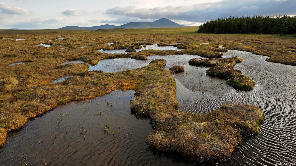

Peatland restoration seeks to recover these degraded ecosystems, mainly by rewetting the soil and reintroducing native vegetation such as Sphagnum mosses. Healthy peatlands store carbon, regulate water, and harbor biodiversity; when degraded, they release greenhouse gases. Their restoration is key to mitigating climate change, conserving species, and securing water resources, with support from international organizations such as the IUCN, Ramsar, and UNEP.
Pedal pump

This type of pump uses hydraulic and vacuum suction principles, operated by pedals, to extract water at depth, even through hard rock, without the need for fuel or electrical power.
Pelton turbine

A Pelton turbine is a hydraulic impulse turbine used in hydroelectric power plants with a high vertical head. The turbine was introduced in 1879 by the American carpenter and inventor Lester Allan Pelton, hence its name.
Peruvian Amunas

Amunas, a word of Quechua origin from Peru that means “to retain,” are a pre-Hispanic system of artificially recharging aquifers through the planting and harvesting of water, which is still implemented by some Andean peasant communities in the aforementioned country, between the Puna and Quechua zones.
Pest and Disease Alert

It is a proactive tool that integrates pest and disease models with real-time weather data to alert about outbreak risks. It enables farmers to take preventive action, reducing yield losses and treatment costs.
Pest/Disease Detection

It is a diagnostic tool that enables the rapid identification of crop pests and diseases from field images. Using advanced computer vision models, users can upload a photo and receive an immediate diagnosis with a confidence level, supporting early and targeted treatments to protect crop yields.
Pishku chaqui

It is an irrigation system in which the water from the river or stream is redirected through a main irrigation ditch. Every certain distance, part of the flow is directed to a secondary irrigation ditch, which is then divided into two by using scaffolds, forming an inverted “Y” shape that resembles a bird’s foot. The water, at the end of its journey through the tertiary irrigation ditches, begins to move by gravity and covers the surface of the land by flooding, thus facilitating the development of crops.
Platforms

Terraces are technologies that, through the action of man, modify the topography of sloping lands, with the purpose of making better use of resources, soil, water and climate, to carry out agricultural tasks. It is formed by a platform (terrace), which is filled with transported and selected material (gravel, soil and organic matter), and supported by walls, usually made of stones.
Pocket parks
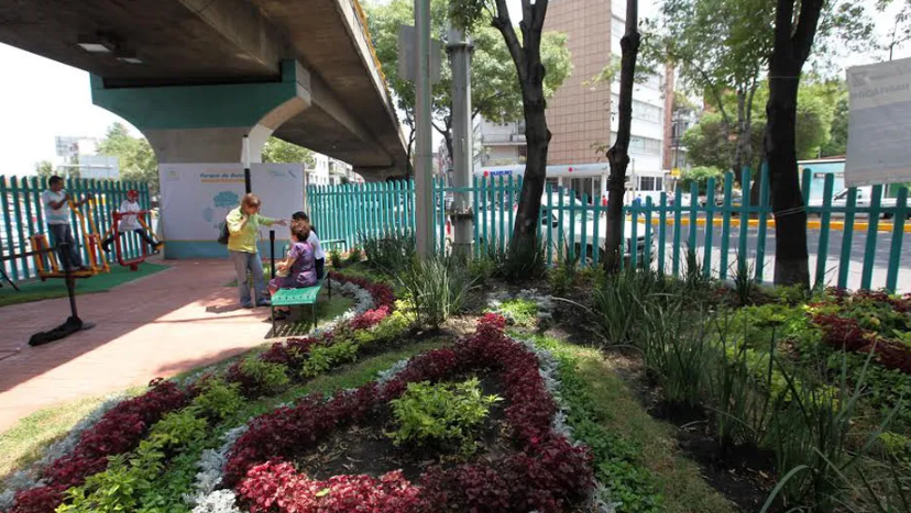
A pocket park is a small green space in urban areas, created on unused land. Its purpose is to provide a nearby place for rest, socializing, and contact with nature, especially in areas with few parks. In addition to improving quality of life and beautifying the city, these parks can also include elements for sustainable rainwater management.
Portable turbine

This device is a turbine constructed with interchangeable blades and a stainless metal frame. It is placed in a water flow, where the movement of the water activates the turbine to generate power. It is effective in shallow and low-velocity waters.
Pre-Hispanic dams

They consist of dams made of stone and clay, which were built by the ancient Peruvians (pre-Incas) with the purpose of storing water to regulate the streams and, at the same time, allow infiltration to recharge the aquifers and thus have water in the springs and wetlands.
ProRindes

ProRindes is a tool that forecasts crop yields for soybean, corn, wheat, and barley in Argentina’s Pampas region. It uses models that integrate climate, soil, and agronomic management data, with updates every 7–10 days. Operated by the National Meteorological Service and other institutions, it supports informed agricultural decision-making and places particular emphasis on water availability, which is key to crop performance.
Productivity zones

It is a precision agriculture tool that automatically delineates zones based on productivity to optimize farm management. Using Sentinel-2 satellite imagery and the MSAVI2 index, it identifies areas with similar characteristics and generates clear productivity-level maps, enabling more efficient allocation of inputs such as fertilizers and irrigation.
QGis for georeferenced water modeling

QGIS is a free and open source Geographic Information System (GIS) software. It allows processing, analysis, modeling and decision making based on geographic and territorial data. In agriculture, QGIS can capture the Normalized Difference Vegetation Index (NDVI), which measures crop health.
Qochas

Qochas or rustic micro-dams are water reservoirs that take advantage of the natural depression of the ground to build a dam that allows rainwater to be captured and stored, thus increasing water infiltration for later use, mainly agricultural.
Rain Bird

Rain Bird is a leading manufacturer of irrigation solutions for commercial, residential, and agricultural applications. It offers products such as sprinklers, irrigation systems, controllers, filters, and valves.
Rain gardens
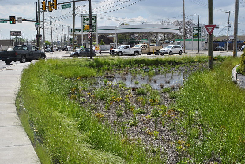
Rain gardens are landscaped areas in depressions in the ground that capture rainwater so that it slowly infiltrates the soil. They are planted with native species that are resistant to both excess water and drought, helping to reduce runoff and protect nearby water bodies.
Ram pump

The hydraulic ram pump is a device that uses the energy of water located at a certain height (the level of a river, dam or other reservoir), which allows the water to be raised to a height greater than the initial height through the physical phenomenon known as "water hammer". The device pumps water continuously and operates without the need for electricity or fuel.
Recycling plants


Water treatment devices use natural filtration with plants, laterite, and esparto—materials commonly found in arid regions. They are safe, compact, and remove significantly more nitrogen and phosphorus than conventional systems. They are ideal for treating wastewater from homes, restaurants, public buildings, and small industries.
Reforestation drones

The main idea behind the tool is to create a low-cost drone with a wooden structure and get it to fly and spread seeds. Its system is 10 times cheaper than manual reforestation methods, as well as being faster and less destructive to the environment than other methods. The reforestation drone will not only produce oxygen, but also function as future entities that capture and store usable water resources.
Regaber

Regaber is a company specializing in professional irrigation systems, founded in 1980. It stands out mainly for its drip irrigation solutions, which are highly efficient and sustainable. Regaber offers a wide range of products and services, including: Drip irrigation systems: Ideal for maximizing water use and improving crop productivity. Filtration and control: Filtration equipment, control valves and regulation to optimize irrigation. Automation: Remote management and real-time control solutions to increase irrigation efficiency and sustainability.
Rivulis

Rivulis is a company specializing in micro and drip irrigation, focused on making irrigation more accessible and sustainable globally. It offers a wide range of products such as irrigation tapes, drippers, sprinklers, filters, valves, and fertigation and automation systems.
Robotics in agriculture

Robotics is revolutionizing agriculture by improving productivity and working conditions. Autonomous systems and artificial intelligence are driving precision agriculture, enabling operations such as automated sowing, harvesting and irrigation. Agricultural robots guide themselves and perform complex tasks, such as weed detection, using advanced technology.
Rooftop cultivation

Rooftops of houses and buildings, with areas ranging from 20 to 200 m², can be transformed into urban gardens to grow family food, promoting self-sufficiency. In addition to improving air quality and contributing to thermal and acoustic insulation, this initiative provides a connection with nature in urban environments.
Rope bomb

This system uses a rope with polyethylene pistons attached at intervals, a semi-submerged PVC pipe and a pulley with a crank.
SCALL rainwater harvesting system

Rainwater harvesting and use systems (SCALL) intercept, collect and store rainwater, and can be used in small-scale agriculture on the roofs of houses and wineries.
SISSA (Drought Information System for Southern South America)

The Drought Information System for Southern South America (SISSA) uses data from the Climate Hazards Group InfraRed Precipitation with Station Data (CHIRPS) product to estimate precipitation. CHIRPS is produced by the Climate Hazards Center at the University of California, Santa Barbara and the U.S. Geological Survey.
Satellite reports

It is an on-demand satellite analysis tool that uses vegetation indices and machine learning to generate detailed maps of crop health and vitality, enabling early detection of stress caused by pests, diseases, or nutrient deficiencies.
Saved

The term “atajados” comes from the word “atajar” or “to stop.” The atajados are small ponds dug into the ground to store rainwater and other sources. They have low construction costs and are appropriate for arid areas with rainfall concentrated in a few months of the year. Traditional technology is used, and due to its size it is suitable for family or multi-family units.
Semicircular ditches


The aim is to dig small, semi-circular pits that retain water. Because of their shape, they are called “earth smiles.” Rainwater that would have previously washed away, eroded and further hardened the surface is retained, water balance is restored and vegetation grows back. Restoring vegetation restores the water cycle. When this is done over a large area, it helps generate clouds, increasing rainfall in the area. This rain benefits vegetation, which continues to improve water tables and desertified lands are transformed into lush, green areas.
Sentek

Sentek is a company that designs, develops, and distributes advanced technologies for measuring and managing soil moisture, salinity, and temperature. Its products, including probes, telemetry systems, and software, enable groundwater monitoring and optimization of agricultural irrigation using accurate, real-time data.
Smart Hydro Power Turbine

This technology consists of a turbine with three blades, each one metre in diameter, connected to an electric generator. Driven by the flow of water, the design increases the speed of the water as it passes through the device, optimising production thanks to the curved shape of the blades.
SmartFruit-ALC FONTAGRO HUB

This platform will promote the development and adoption of technological solutions based on precision agriculture to strengthen the competitiveness and sustainability of family fruit systems (FFS) in LAC. The platform develops a collaborative IT tool called “OpenFruit” as a precision agriculture technology for small producers and fruit advisors in participating countries.
Soil information
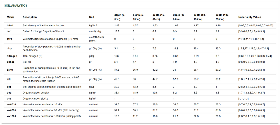
This is due to an intuitive soil analysis application that allows rapid access to comprehensive soil data. With just two clicks, users enter GPS coordinates and instantly obtain detailed physical and chemical properties for each layer of the soil profile, based on an extensive database.
Sponge city

The “sponge city” concept represents a good example of improving urban water supplies on a large scale, largely based on the application of green infrastructure approaches in urban landscapes, mainly to improve water availability.
Stages of coffee growth

It is a specialized coffee monitoring tool that remotely identifies growth stages using satellite imagery and machine learning. It classifies farms into Seedling, Vegetative, Maturation, and Fallow, enabling precise and timely agricultural management.
Stubble or organic matter

Covers are an effective solution to counteract losses through evapotranspiration, as they conserve moisture and reduce the influence of solar radiation and wind on plants and soil. They also optimise irrigation efficiency.
Subsurface drip irrigation

Subsurface irrigation, an agricultural technique, supplies water and nutrients in a localized manner underground, improving crop growth.
Suka Kollus

They are a pre-Hispanic agricultural system developed by the Tiwanaku culture in the Andean region. This system consists of the creation of elevated cultivation platforms interspersed with water channels. The channels, known as suka uma (water furrows), surround the platforms and help drain excess water and moderate temperatures, protecting crops from frost.
Sun filters

These are compounds that can be of natural or synthetic origin, and that when applied directly to plants, generate a protective layer that reduces direct solar radiation, maintaining optimal levels of transpiration and reducing thermal stress. Sun filters for plants can be found in various formats, either wettable powder or liquid, and generally contain similar formulations. They are applied foliarly, and their benefits are almost immediate, giving the crop a protective layer against UV and infrared rays, while allowing gas and water exchange at the stomatal level to remain uninterrupted, so the plant continues to grow and produce but with less stress from radiation and temperature.
Surfactants

They are liquid additives that, when added to irrigation water, reduce surface tension and improve soil wetting. This increases irrigation efficiency by minimizing water and nutrient losses through percolation and runoff. They are easy to apply, and their effects are immediate once dissolved in the irrigation tank.
TETIS

TETIS is a distributed hydrological and hydraulic model developed by IIAMA-UPV that simulates the water and sediment cycle in river basins of any size, representing physical processes in detail within each grid cell of the territory. It includes automatic calibration and can operate at short time scales (floods and flash floods) and long time scales (water resources and erosion). Its versatility makes it useful for water management, risk prevention, and hydrological planning, and it is used by institutions such as the Basque Water Agency.
TaKaDu

TaKaDu is a cloud-based Central Event Management (CEM) solution that enables utilities and private companies to detect, analyze, and manage network events and incidents such as leaks, explosions, faulty assets, operational failures, telemetry and data issues, and more.
Tajamares

It is a small artificial reservoir that stores rainwater and surface runoff. It is mainly used in rural areas of Uruguay to provide water for livestock and other agricultural activities, while also supporting local biodiversity.
Taranis

Taranis is an agricultural intelligence platform that uses advanced images and artificial intelligence to detect pests, diseases and deficiencies in crops, helping to improve their productivity and profitability. In addition, its technology can be applied to water quality monitoring, detecting contaminants and assessing risks of floods or droughts in agricultural areas.
Teralytic

Teralytic is a soil health company that offers advanced technology to provide real-time data on soil conditions. Its flagship product is a 26-sensor probe capable of measuring moisture, salinity, nutrients (NPK), temperature, aeration, and other key factors at various depths, helping farmers make more accurate decisions and improve their yields.
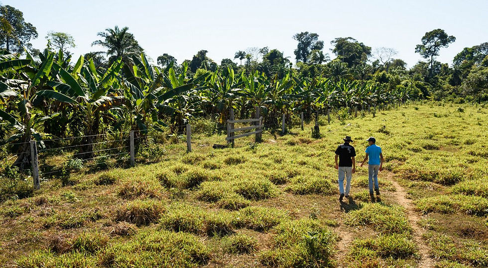
The Amazonian Chakra

The Amazonian Chakra is a traditional agroforestry system practiced by Indigenous peoples of the Amazon that combines a wide diversity of crops, forest species, and medicinal plants within the same plot. This model promotes biodiversity conservation, the sustainable use of water and soil resources, food security, and resilience to climate change.
Tree counting

It is an inventory tool that performs accurate large-scale tree counts from aerial or satellite imagery. Through automated detection, it generates a reliable census to assess planting density and manage agricultural assets.
Trimble Ag

Trimble Ag Software is a platform designed to help farmers manage their farming operations more efficiently. It offers a variety of tools and applications that allow farmers to plan their crops, run jobs in the field, monitor their fields in real time and keep detailed records for the entire farming year.
Trusty

Trusty is an app designed for precision agriculture, helping farmers optimize their farming practices through the use of advanced technology. This app allows users to monitor and manage their crops efficiently, using real-time data to make informed decisions about irrigation, fertilization and pest control.
USGS Hydrologic modeling software

Models developed by the United States Geological Survey (USGS) are widely used to predict the responses of hydrologic systems to changes such as increases in precipitation or groundwater pumping rates, and to anticipate the movement and fate of solutes and contaminants in water, crucial aspects of agricultural production.
Ultrasonic buoys
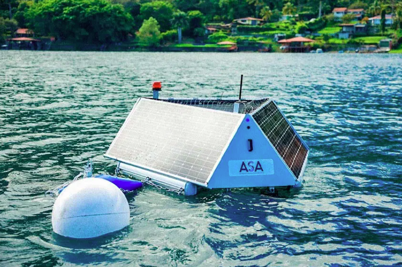

Ultrasonic buoys are an environmental technology that monitors and improves water quality in rivers and lakes through ultrasonic waves that control the growth of microalgae without using chemicals. In addition, they include sensors that measure parameters such as temperature, pH, and oxygen in real time, and by operating with solar energy, they provide a sustainable solution to protect aquatic ecosystems.
Underground dams

This is a technology for storing water underground that involves the generation of small, artisanally confined aquifers (volume of underground soil saturated with water).
Use of bioindicators

A bioindicator is a living organism that can be anything from a microbe, an insect or a fish, to a plant or algae, that allows us to quantify and qualify the level and evolution of contamination present in an aquatic system by determining its differential sensitivity to various toxic substances. Sampling of macroinvertebrates is linked to sampling of the chemical quality of the water.
Utilis

Satellite technology using SAR sensors that detects underground water leaks with high accuracy from 650 km altitude. It can identify losses as small as 0.5 liters per minute up to three meters deep and within a 100-meter radius. It works day and night, in any weather, and can distinguish between drinking water, wastewater, or surface water. It enables rapid detection of hidden leaks, saving time, water, and money.
Valley Irrigation

Valley Irrigation is a world leader in precision irrigation technology, specializing in center pivot and linear irrigation systems that maximize water efficiency and crop yields. Its products stand out for their durability, reliability and advanced technology. In addition, they offer remote management solutions that allow farmers to monitor and control irrigation from anywhere, helping to conserve water and optimize schedules according to the needs of each crop.
Virtual reality

Virtual reality overlays real-time digital information using devices, improving efficiency. In agriculture, it benefits productivity and water management, allowing for accurate measurements, crop analysis, water flows and irrigation optimization.
Vortex Turbine

Electric power is essential in agriculture for tasks such as automated irrigation, machinery, heating, transportation and processing. One way to generate electricity is through the gravitational flow of water.
WATEX: Groundwater exploration

French physicist Alain Gachet was working on hydrocarbon exploration in Libya using the Watex technology he had created through his company RTI Exploration. That was his field of development: oil. While searching for this fuel, he accidentally found a deep water leak in an underground aqueduct in the middle of the desert.
WaPOR


FAO's Water Productivity through Open Access of Remotely sensed derived data, WaPOR, monitors and reports on water productivity in agriculture in Africa and the Near East. It provides open access to the water productivity database and its thousands of underlying map layers.
Warka Water

Warka Water towers are passive bamboo structures that harvest drinking water from the air through condensation, using natural processes such as evaporation and gravity. They are 10 meters tall, weigh about 60 kg, and are built from triangular mesh panels divided into five modules. Depending on air humidity, they can collect between 40 and 100 liters of water per day, making them suitable for use in different regions worldwide.
Waru Waru

The waru waru are an ancient practice of the ancestors of the Tiahuanaco culture, which was located in the highlands between Bolivia and Peru, above 4000 m above sea level.
Water Loc

The WaterLoc underground structure is a modular system designed to retain large volumes of stormwater. It is specifically designed for the construction of underground retention tanks that effectively manage stormwater.
Water control towers

They are physical centers that enable real-time management of integrated water cycle services and the territory’s environmental health, from data capture to analysis, visualization, and remote control. They support smart city development and climate action by optimizing decision-making for urban water infrastructure through advanced, territory-adapted technology, ensuring efficient and sustainable water supply, sanitation, and reuse.
Water management platform for agriculture 2030

The project will implement pilot plots with technologies such as satellite images, field sensors and specialized software to improve irrigation management. The aim is to modernize irrigation techniques and strengthen monitoring and analysis of information at the plot and watershed level.
Water risk information atlas

Aqueduct Risk tools use open source, peer-reviewed data to map water risks such as floods, droughts, and water stress.
Weather stations

Automated weather stations, with electronic sensors, collect real-time weather data, vital for agricultural decisions.
Wheel pump

This pump consists of a water wheel with blades and a spiral flexible pipe attached to the wheel.
Yield prediction

It is an advanced field-level yield forecasting tool used throughout the growing season. Using machine learning, it integrates satellite imagery, weather, and soil data to deliver reliable estimates, supporting marketing, financial, and logistics decisions.
Zahori Method

The dowsing method is an ancient technique that aims to locate underground water wells and find out the flow or volume, depth and even its potability. The method is also known as "dowsing technique" and the dowser as "radiesthesist". It consists of stimulating the senses using simple elements in the form of a rod and pendulum, which amplify the radiation to detect water currents, magnetic flows, underground lakes, mineral veins, etc.
Zamorano tank

The Zamorano-type tank is a circular structure made of metal sheets with an internal bladder for water storage, commonly used in rural and agricultural areas. It is an efficient and low-cost solution for irrigation and other needs, helping address water scarcity, improve food security, and adapt to climate change, while also supporting household income.